
Membership of Type allows unlimited access to our online library. Join to support new research and writing on the design of the built environment.
You can read more about membership here.
Already a member? Login to your account to avail of unlimited downloads.
Membership of Type allows unlimited access to our online library.
Join to support new research and writing on the design of the built environment.
You can read more about membership here.
Individual Membership Fees
Individual membership is available on a monthly or annual basis.
The fee is €10/month or €99/year.

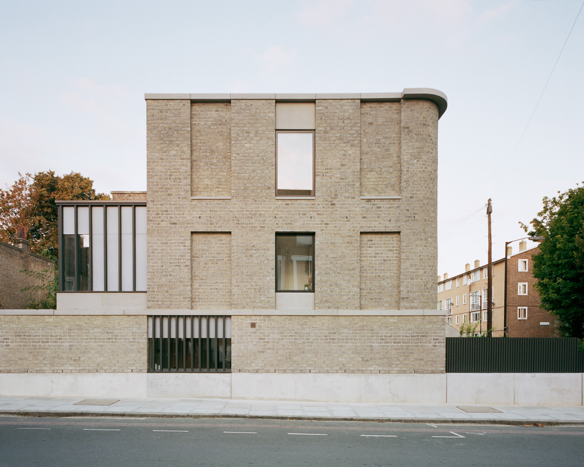
Nestled behind the Crocknamurrin Mountain Bog, beyond the sublime of the Glengesh Pass, lies the town of Ardara (Ard an Rátha), a rural village in southwest Donegal with a population of about 750 people. The context of southwest Donegal, like much of the West of Ireland, is characterised by a harsh environment shaped by the Atlantic coastline and its famed remoteness - factors that have long contributed to the allure and longevity of its most renowned export industry: Donegal Tweed.
In the spirit of the series, this article looks not towards whether a place is working hard or hardly working, but instead towards what we might glean from turning our attention to spaces of work themselves; what they might tell us about the story of a place, of how an emergent rural town found itself at the heart of a thriving cottage industry, and how that legacy continues to shape the fabric of this place today.
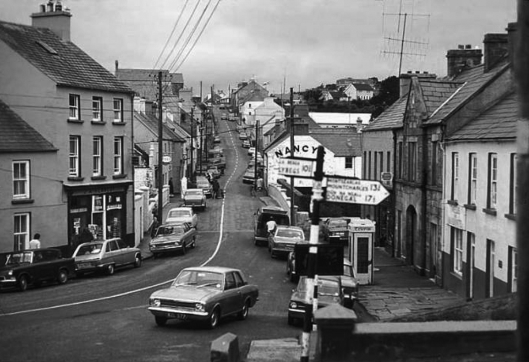
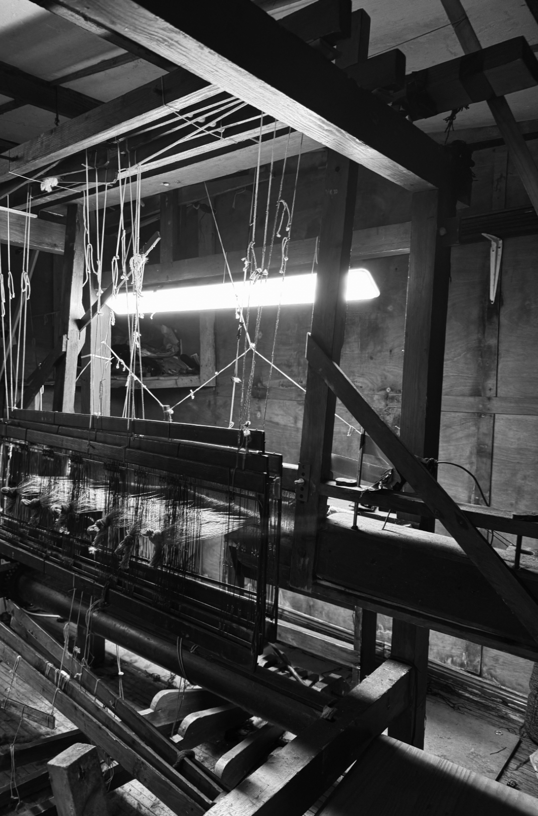
Anecdotal accounts refer to the sounds of working looms echoing through Ardara’s streets, where a trained ear could identify who exactly was weaving by the distinctive and unique clatter of their shuttle. A trade sustained by cottage industry into the 1970’s, looms were typically kept in working weaving sheds independent from the house – an early iteration of working from home before the concept of WFH as we have since come to know it. Separate from or to the rear of someone’s home, space for weaving has long been understood as a working shed more so than a studio space, or a place for artistic expression.
An informal environment, the weaving shed is carefully shaped by and for its user, with maximum practicality and ease of production in mind. What presents at first a disorderly chaos of timber sections, scrap yarns and curious tools reveals, on further interrogation, a perfectly planned and functional ecosystem. Level access is optimal for transferring heavy beams and yarns; garage doors to a laneway accommodate the proportions of double-width warp beams, and their loading in and out of trailers; 2.4m clear height allows vertical movement of the jacks, while 3.5m in width is required for swinging of the sley; a single LED light fixture plugged loosely into an extension cable illuminates the cloth beam for intricate on-loom mending, and so on. Beneath the tangible disarray of objects worn and used is something intangible – behaviours, habits and knowledge passed down through generations, linking this intimate, private space and its geographical location on earth inherently and forever to the identity of a craft. Workshop spaces like these belie the story and success of a place in ways both material and immaterial.
Geographically, the challenging conditions of mountainous bog terrain engendered a sense of isolation that contributed to the preservation of these traditional craft techniques. This terrain also provided the natural materials and resources required to produce and dye handwoven woollen textiles in times when communities were largely self-reliant, and living off the land.
In an economic context, Ardara’s textile industry has experienced periodic success punctuated by significant challenges. The Wool Act of 1699 implemented by the British Parliament prohibited, during a time of great success in the European market, the export of Irish woollen goods beyond the UK, to protect the English wool trade from competition with growing, colonial markets.
Ardara’s textile industry was supported by initiatives implemented by the Congested Districts Board, established by Arthur James Balfour at the end of the 19th Century with the intention of “killing Home Rule with kindness”. It is said that a visit paid by him to Donegal, prior to his establishment of the Board, “first opened his eyes to the poverty and misery prevailing there and brought about a change of heart” [1]
The Congested Districts Board's initiatives were designed to support local production and provide employment to areas that historically had relied on agriculture and home-based crafts. For Ardara, this took the form of the introduction of stamping high-quality handwoven goods, and led to the construction of a Mart building in 1912, where weavers would traverse from all over the rural area with their homespun frieze for inspection, storage and sale to the global market. [2]
The Congested Districts Board was purportedly involved in the provision of an improved hand-loom for weaving, invented by Mr. W.J.D. Walker, the Board’s organiser and inspector for industries, who generously placed his invention at the disposal of the Board. These improved looms were then supplied to the local weavers on a loan installment system.
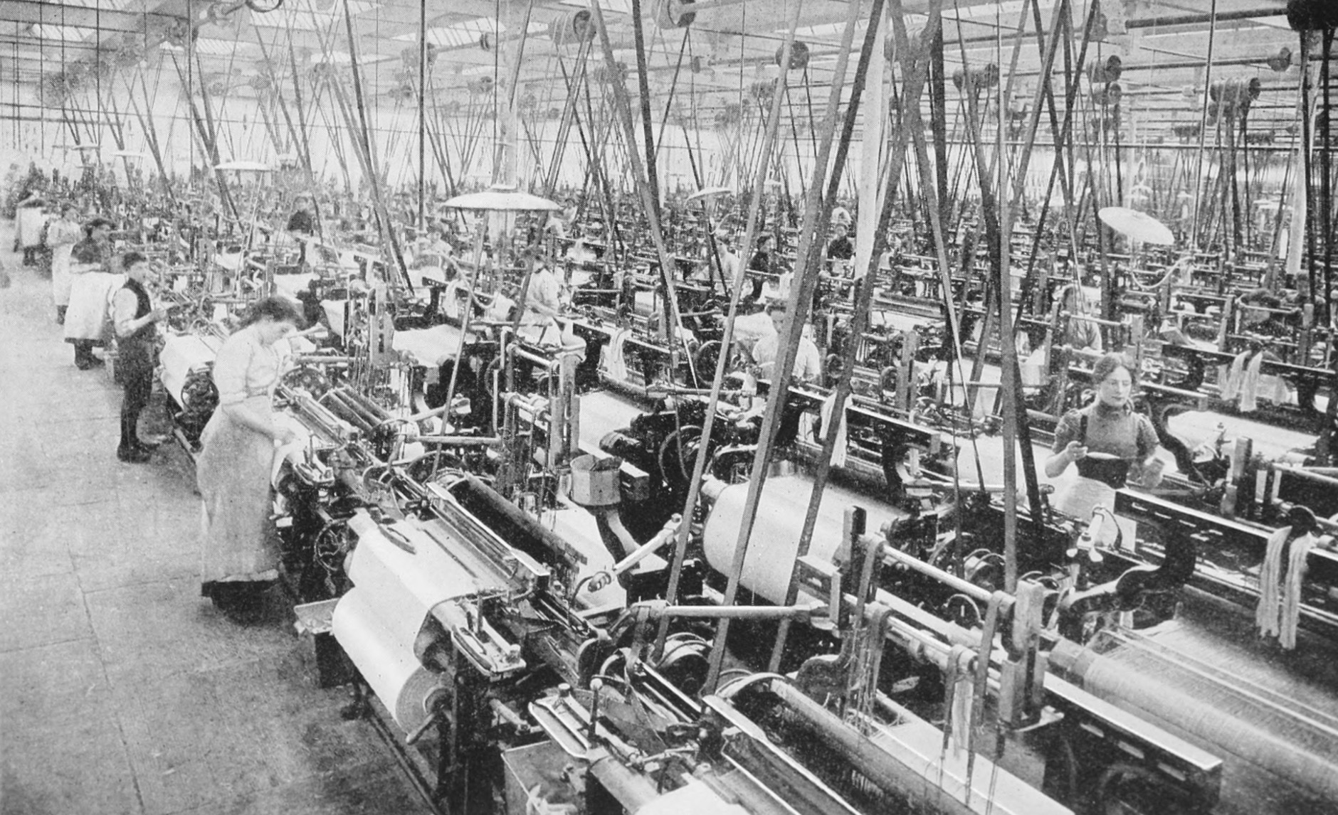
Although it was arguably established to consolidate British influence in the region, it cannot be denied that the Congested Districts Board aided in supporting this cottage industry at a time where it was in decline and uniquely, in establishing a network between towns in southwest Donegal; linked by the spinning factory in Kilcar, to a carpet factory in Killybegs, to Magee’s in Donegal Town, to the handweavers and Mart of Ardara and its surrounds. Whether intentionally or not, this network has enabled not only the craft to endure in harsh climates - meteorological and economical - but also, the make-up of these places, how they interact with one another, and what is literally woven into their urban and rural fabric.
Often when looking at public space or the development of towns and their successes, with an architectural lens we look to the physical - how trade, culture, or industry have physically shaped a place. In this instance, to begin to understand this place, it is necessary to observe how these same cultural influences have shaped a town in an immaterial, intangible, maybe even invisible way. The weaving shed as it has always existed, is a fragment of industry previous; a byproduct of its environment, natural resources and the resourcefulness of the people who inhabited it and sustained a craft.
In Teague’s pub you’ll find pillow cases handwoven by John Heena leaning against the snug at the front, and a beautiful shuttle placed above the door that once belonged to the owner’s grandfather. Ask anyone in the town and they will likely know something or have some connection to weaving, be it an old loom in their shed, or some lingering knowledge of how to construct parts of a loom. This almost inherent shared knowledge and understanding provides a mystical reminder of the vibrancy and prevalence of a once commonplace skill.
Across Ireland we have seen a surge in the value of craft, of people returning to making things from scratch, growing foods from the earth, using their hands to create, all in response - and sometimes protest - to the mass production, consumption and colossal waste that is draining our planet’s resources. Following the introduction of power looms in the 1970’s, the industry changed, making Donegal Tweed a legitimate and successful export worldwide which continues to thrive today. On a smaller scale, we find ourselves in a different cycle of weaving, where the focus lies on the craft of weaving as an artisanal trade, rather than a scalable business model.
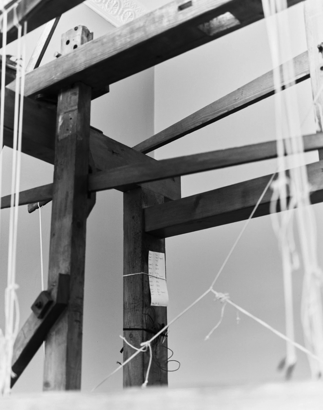
What was introduced earlier in this article as a humble, pragmatic workspace presents itself now as evidence of living heritage, a fragment of an industry past and an emblem of the future of handweaving in Ireland. It prompts a wider reflection on the revitalisation of Irish towns at large, examining their interconnectedness and the intangible forces that bind and sustain them. A holistic, ground-up approach is critical to any and all revitalisation efforts, rooted in the understanding of a place and responsive to the needs of its future; remaining ever mindful to see the story behind the shed.

Working Hard / Hardly Working is supported by the Arts Council through the Arts Grant Funding Award 2026.
[1] Donegal County Council Heritage Office, ‘Ardara Heritage Town’, 2008, available at: https://www.donegalculture.ie/media/l2pfjh0e/ardaraheritagetownbrochure.pdf [accessed 30th January 2026]
[2] Seán M. Ó Conchubhair, ‘The Congested Districts Board’, The Irish Monthly: Irish Jesuit Province, Vol. 69, No. 820 (Oct., 1941), pp. 477-488
MB: When I started the podcast seven years ago, the decline in architectural criticism had already been notable for years — in the loss of dedicated critic positions, the shrinking cultural authority of criticism and the migration of discourse away from newspapers and toward fragmented digital platforms. Attention had shifted toward listicles, images, or promotional pieces masquerading as criticism. Architecture writing became something more akin to clickbait. That was part of my reason for starting the podcast. I wasn't finding the coverage of architecture I was hungry for, so I decided to go out and speak with architects myself. At the same time, I was listening to — and still listen to — a lot of podcasts, and I find the long-form interview is an ideal way to pay sustained attention to a subject. It's an opportunity to sink into someone's ideas and follow a line of reasoning through, with less distraction than visual or screen-based media.
I always enjoyed shows like Bookworm [1], hosted by Michael Silverblatt out of KCRW in Santa Monica, where every week he'd speak with a different novelist about a recently published book. Over the past 30 years he's spoken with some of the greatest literary figures in the world, and he has a way of cutting through the PR exercise of a public interview and getting to the heart of the writer's work and their motivations — sharing insights you wouldn't expect from a journalist. It's a much more intimate format.
Another I listened to fanatically was Longform [2], an hour-long interview each week with a different journalist about a recent piece they'd written. It offered a level of intimacy around someone's craft that you don't see on a screen.
MB: This is probably one of the hardest questions to answer, because the editorial intent has always been fairly subconscious. But it was likely informed by my background in English literature and my interest in architecture as an outsider to the discipline.
I read a lot of Geoff Manaugh's writing on BLDGBLOG [3], a blog from the aughts heavily inspired by writers like J.G. Ballard, ie: people who saw architecture always in connection with a wider set of influences. So architecture was always an expanded field to me, which has informed who I speak with. It's not just architects, but artists, designers, landscape architects, novelists, poets — people whose work might not be rooted in practice but is, at least in my view, connected to it.
MB: There's been a real atrophy of architectural criticism — but really it's more a decline of the public intellectual more broadly, tied to much larger shifts in media. Criticism is no longer a top-down process where experts at prestige publications impart their knowledge to a readership. Instead it's much more democratic and messy and specific, with more people expounding to much smaller audiences. That's part of why podcasts have proliferated in the past decade.
There are still good architecture critics, don’t get me wrong — I read Olly Wainwright [4] and Christopher Hawthorne [5] , and there are many others behind paywalls now whom I once read more often — Edwin Heathcote [6] and Rowan Moore [7], for example.
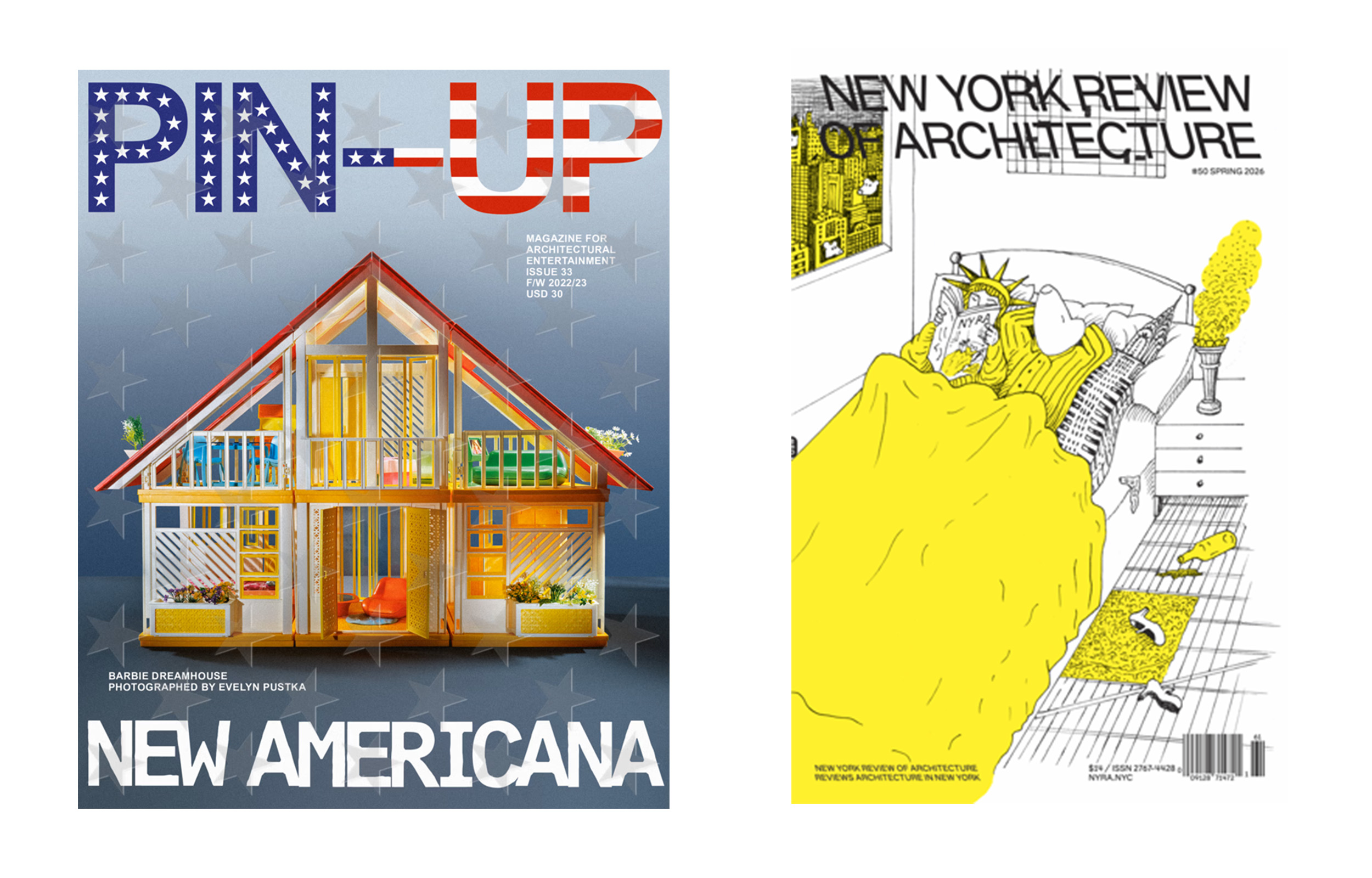
There are publications like PIN-UP [8], which balances rigour with a real sense of glamour and sex appeal, as far as architectural writing goes at least, and the New York Review of Architecture [9] which to me is one of the most exciting publishers of architectural criticism today. The most recent issue of NYRA features a face-off review of Foster’s 270 Park Avenue, between Paul Goldberger and Mark Krotov. There's a sense of drama to how the essays are formatted, running in parallel across the gutter of the paper, and the writing itself is sophisticated, entertaining and at times exhilarating.
I know I’ve veered away from the question of criticism and towards architecture writing more broadly, but it’s worth mentioning here for readers that the two pieces of recent writing I hold close to my heart are both works of long form journalism, and both from the New Yorker: Ian Parker’s 2024 piece on Kanye West’s Tadao Ando-designed Malibu house [12], which braids together the stories of West, Ando and the contractor living on site who was being paid by West to destroy the building. The other is Sam Knight’s 2023 piece on a young architect who struggles to reconcile his radical environmental vision with the realities of the mainstream architecture industry. [13] This isn’t formal architectural criticism, but in some ways far better!
MB: It's funny — Bookworm doesn't exist anymore. Michael had a stroke and isn't able to work. Longform ended two years ago. And in my own media diet, especially my podcast diet, it's more and more material that is functional and efficient — about digesting current events, or improving my health or productivity. The culture of optimisation really feels all-pervasive now.
There's less space for a kind of intellectual engagement that on the face of things isn't useful or productive, but on a much deeper, almost spiritual level is still fulfilling. That's a high-minded way of putting it, and I don't think I get close to achieving it — but it's something I always looked for. When I was a student in English literature and listening to shows like Bookworm, it was kind of like going to church and having revelations. I don't think we value that, or look for it, in the same way now — at least not in the discussions about architecture we have.
A lot of mainstream architectural criticism now leads with carbon footprints, housing affordability, labour conditions, displacement, accessibility, or the politics of who's commissioning what. These are urgent and legitimate frames, but they tend to displace an older register of criticism — the kind that focused on atmosphere, proportion, threshold, light, the phenomenology of moving through a space. There's arguably less attention paid to the experiential qualities of the built environment in architectural criticism today, because they don't always have this moral or utilitarian edge.
MB: There's the term TLDR — too long, didn't read, just give me the bullet points. And increasingly, popular architectural writing is probably formatted in that manner.
But the interesting, experimental writing I've been reading lately — most recently from an artist named Jaakko Pallasvuo [14] , who's based in Finland — is that the text isn't really a product. Becoming a product isn't the point. The writing he and a lot of his contemporaries do is interested in rendering the labyrinth of thinking, and having the reader follow that labyrinth and take pleasure in the process of thought unfolding. It's very resistant to summary or artificial synopsis — if you tried to apply that to writing like Pallasvuo’s, it becomes totally insufficient, so much weaker than the original.
A long-form interview can work the same way: it meanders, you're not sure where it might go, and at its best it's totally dependent on two minds being open to some kind of mutual discovery. That frankly doesn't happen often, but it's the aspiration — that there's an element of chance and even magic when you get two brains together unpacking ideas, exposing themselves in ways that might not happen on a page or in front of an audience, revealing underlying forces or preoccupations that would be hard to uncover otherwise.
MB: I think it's even harder to bypass the sales pitch with architects than with other cultural workers, because architecture is so bound up in capital and risk and reputation that all good architects are, by definition, excellent salesmen.
And there's another layer to it: architects are notorious for speaking in a very inaccessible way about buildings — precisely, I think, because their medium is space and material and light, things that are effectively ineffable. So we always do a pretty bad job of talking about architecture.
Part of the challenge of having a genuine conversation with an architect is creating the conditions where they can speak more freely. There's a kind of conversation that architects (and artists, writers, etc) rarely get to have, which is one where the interviewer isn't extracting a quote or a story that flatters (or flattens) the project. It’s this extractive frame that produces guardedness. What dissolves it is usually some demonstration that you're genuinely curious about the same questions they are.
MB: I just had this image of the magician on stage performing some miraculous feat — which is maybe a useful metaphor for the architect, who can make building look so easy and fun at the same time, when in fact there's often so much agony that goes hand in hand with the design of a building, or any creative act. For publicity's sake, all of that is masked or concealed.
One of the aims of the podcast is to pull back that curtain — to take the struggle and the complexity as the subject matter, not the perfect final image.
MB: Architecture makes us acutely aware of how form and content, or style and substance, are inextricably bound. Language is part of that. You can't entirely separate the rhetoric of a text from its fundamental meaning. You have to accept that it's as much about how we frame things, how we decide to look at them, versus how they really are. I've always enjoyed that puzzle — trying to get as close to what I feel is the “real thing.”
And there's this thing I often mention when asked to explain the podcast: the name Scaffold is really about language and how it both supports and obscures the object of interpretation. Buildings are so dependent on rhetoric to be made sense of, and the way you describe something changes the way you see and understand it. But at the same time there's an innate property to a building that you maybe start to lose touch with as you focus more on the language around it. The words can get in the way. Somehow I am drawn to that contradiction.
MB: I always record a lot more than I publish, even if the final episode might still seem sprawling and rambling. I see the interview as a process of almost panning for gold — I accept there will be a lot of unusable material, probably down to my own lack of skill in conducting the original conversation, and I'll edit quite rigorously to keep the most valuable parts.
MB: I'm extremely self-conscious as a writer, and I'll often erase and rewrite to such an extent that it's hard to make any progress at all. With a conversation, you can't go back. You're on the train, moving forward, and self-censorship or self-criticism is replaced by a sense of urgency — to express, in the moment, to the best of your ability, what you're trying to say.
I like the pressure of the conversation, that you have an audience, that the words simply must arrive one after the other — sometimes even before you really know what you're going to say. There's something exciting and beautiful and mysterious about the process of speaking. For a time, I would actually sit in on Quaker meetings for that reason, and it's a similar kind of dynamic: you sit in a circle, and at some point someone just begins to speak. It comes from somewhere else — somewhere less conscious, and more revealing. Ideally, every interview becomes like a Quaker meeting of two.
An interview with Matthew Blunderfield, host of Scaffold podcast, that touches on architectural media, podcasting, and the value of long-form content in a distracted world.
Read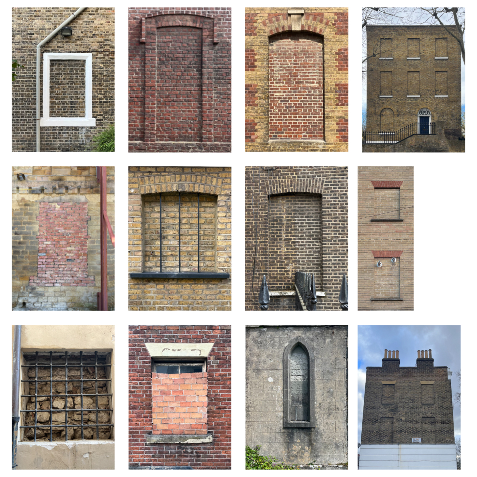
Almost accidental, what I noticed on a long walk through Georgian Dublin during my Covid-era masters. A Joycean pilgrimage of sorts; as I referred to it at the time. The kind of walk that only really makes sense when there is no end destination or objective; head up, moving slowly, paying particular attention to things that do not obviously demand it. I was outside; the city [or even the imposed 5-kilometre radius for that matter] was the only material I had to work with.
I began noticing them the way you notice anything in a place walked long enough. First, an irregularity; then, a recurrence; and eventually, a quiet population of peculiar instances. A small rectangle of brickwork, its colour not quite conforming with the rest of the patchwork. Mortar slightly younger, lines a little too neat. You might see it as a window that has kept its shape but abandoned its purpose. Passing it without thinking, later the eye returns; and I can’t say why. They appear the way a new word would; suddenly everywhere, in sentences you were certain never contained it before. The smallest of absences settled calmly into the streetscape, never quite dramatic enough to halt a passer-by, never misplaced enough to provoke alarm.
What I had been calling a blocked window is perhaps more accurately described as blind. The name is more fitting than it first appears. They are not sightless exactly; they see nothing, but they are seen. They look like windows. They just no longer look out.
Windows normally behave with discipline. They repeat across a façade with the certainty of grammar: opening, wall, opening, wall. A rhythm the eye follows almost without instruction. A blind window interrupts this established order without quite breaking it. The shape remains obedient to the pattern, but the depth has disappeared. The eye expects reflection, even an essence of interior life, but is instead met with brick where the gaze once was. The building nearly seems to mispronounce itself or stutter; you begin to reread.
The usual explanation arrives quickly at this point: the window tax. [1] Count the openings, charge the owner, watch the windows disappear. A convenient explanation, likely even; but not the full one.
Blind windows predate the tax by some distance. They appear in earlier European façades [2] not through force but through composition; a way of holding rhythm, completing symmetry, or resolving something that would otherwise falter. In these cases, the window never intended to open. It existed to make the building read correctly. The tax simply gave the practice a more pragmatic justification. Brick replaced glass, light was traded for economy, and the outline stayed put. Dickens complained, accurately enough I would add, that the state had found away to charge people for what nature had provided freely. [3] But the behaviour itself was already commonplace.
I believe that the important point is this: the blind window is not only something removed. It is something intentional, something designed.
Georgian architecture in particular seemed comfortable with this ambiguity. Windows were used to complete symmetry, to maintain the rhythm of a façade even where the internal arrangement refused to cooperate. This is the part that tends to get lost in the window-tax story; the blocked opening might not always mark something lost, sometimes it marks something that was never intended to exist in the first place. Depending on how charitable you are feeling, is either an act of architectural control or a very convincing illusion.
Some closures followed other forms of adaptation. Houses once built for single families were divided into smaller dwellings. Townhouses became offices, then flats and then offices again. Fire regulations changed [not sure if much needs to be said here, given the regulatory sphere that we find ourselves operating in], internal staircases moved, corridors appeared where rooms had previously opened freely onto one another. A window that once lit a stairwell or overlooked a neighbouring garden, simply ceased to make sense within the new arrangement of life. Cities are this funny phenomenon, whereby they rarely demolish themselves wholesale. They revise themselves instead; slowly. Piecemeal.
Remove an opening and the room reorganises itself almost immediately. Furniture shifts. Services take the wall. Artificial light replaces daylight. The interior absorbs the loss and continues. From the street this transformation is almost invisible. The brick presents only a fact of closure, while behind it, the room has redistributed its functions elsewhere. The sealed aperture becomes less an ending and more a prompt; a small engine for rearrangement, quietly encouraging the interior to find a different equilibrium.
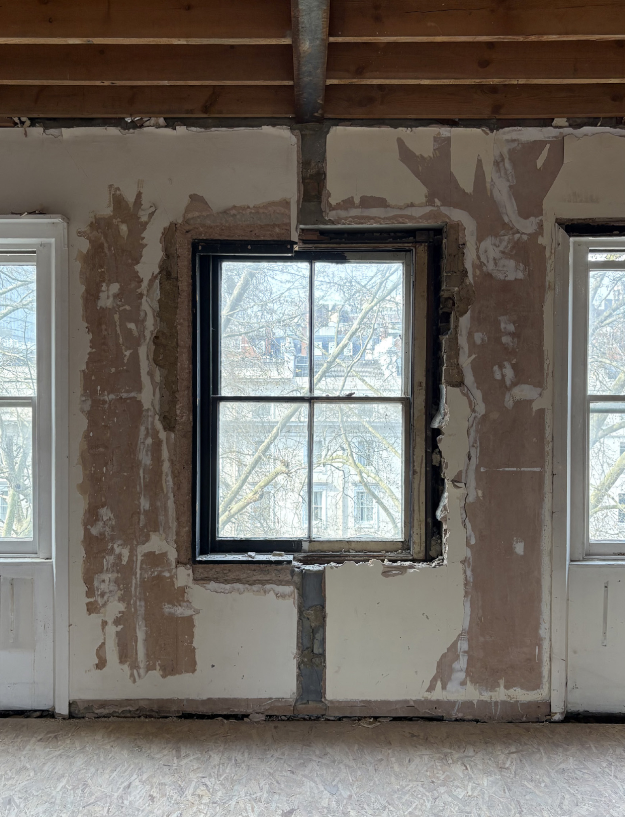
On a recent project, this split between façade and interior became unusually clear. A Victorian sash window reads normally in elevation: frame, glazing, proportions intact. Behind it, the opening had been filled to allow a partition wall to bisect the room, forming two dormitory bedrooms from one. During enabling works, the infill was temporarily removed to inspect the condition of the original sash. A brief moment saw the room’s depth return. Daylight reaching the reveal again, briefly, as if it had been waiting. And just like that, the window lost its gaze again. Without, the façade never told.
Window, wall, window, wall.
Once this split is understood, blind windows begin to look less like accident and more like method.
Contemporary projects use them deliberately: to maintain the cadence of a terrace where a real opening would create overlooking problems; to complete an elevation where internal planning might refuse to cooperate; to keep a building legible within a stricter urban order.
Corner House by 31/44 Architects in Peckham [4] is one such example of this, and one I happened across by accident on a walk from New Cross to Brixton with a friend, somewhere between the second pub and a particularly tasty plate of cumin hand-pulled noodles at Silk Road. A new-build house tucked onto a side-plot street corner beyond the established building line, only ever so slightly announcing itself. The side elevation uses blind windows to turn the corner of the façade with a modesty that mimics what might once have been a full flank wall of sealed openings on an end of Georgian terrace. On the front, a shift in the depth of the brickwork above the entrance marks where the neighbouring terrace has a window and this building does not; a quiet acknowledgement of what is absent, handled with enough restraint that most people would walk straight past it.
Robert Venturi argued that architecture is at its most interesting when it accepts contradiction rather than resolving it; when things are allowed to be both one thing and another simultaneously. [5] The blind window sits comfortably within this definition. It is a window. It is not a window. It maintains the appearance of an opening while withholding its function. From the street it participates fully in the composition; from the room behind it, it does nothing at all.
Aldo Rossi would recognise something else: the persistence of form beyond use. [6] Elements endure even as their original purpose dissipates. The blind window is one of these persistent forms; a familiar figure that survives the loss of its original task, continuing to fulfil a role in the façade long after the room behind it has moved on. Colin Rowe's reading of the city as collage rather than composition finds its evidence here too: less a unified statement than a layered accumulation of adjustments, compromises and continuities. [7] Within that collage, the blocking of a window is a small but legible fragment; a mark where composition, regulation and use have failed to align, and have been forced instead into coexistence.
Has what began as workaround become technique; has the exception quietly become the rule?
It is tempting to read blind windows as signs of decline or neglect. More often they indicate the opposite. A blind window usually means the building is still being used. Someone changed the layout. Someone needed another room. Someone made a decision that prioritised the present over the architectural purity of the past. It would be reasonable to object to this, but as the ever-increasing market for retrofit and adaptive re-use has taught us, rarely is a building going to entertain its intended purpose for the entirety of its lifetime. If one is being honest, it is also largely the reason cities manage to survive.
Walk any old street and the evidence accumulates: one filled opening in a terrace; a row of them high on a warehouse wall where floors now exist; occasionally a single upper window sealed so carefully it nearly escapes notice, surfacing only when the afternoon light flattens the façade and the blank rectangle re-emerges. Brick slightly smoother, mortar a fraction younger. The room that once looked out has long since turned inward. The building continues without complaint, carrying the revision proudly in its wall.
The modern city is not a finished composition. It is an edited one; clauses inserted, sentences shortened, margins full of second thoughts. Blind windows are where edits remain visible: soft marks showing where the city has paused, reconsidered, and rewritten itself.
Most of the time, nothing announces the change. You already had to be looking.
Walking through the streets of Dublin and London, Luke Dillon reflects on the evolution of blind windows as an architectural motif and their ambiguous performance as both practical requirement and deliberate compositional tool.
Read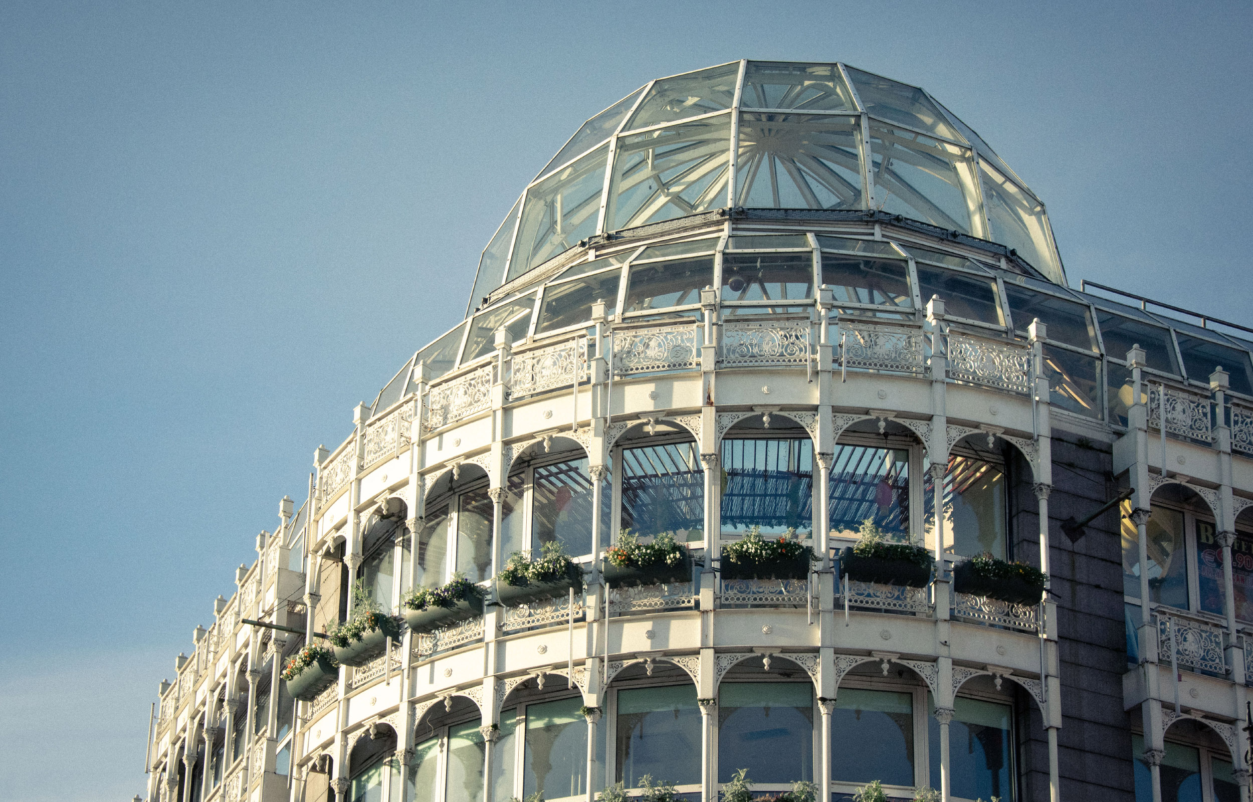
Walking up Grafton Street in the early morning hours one can catch Stephen’s Green Shopping Centre’s dome glistening in the sunlight, a historicist mirage standing out at the heart of Dublin city. At the top of the street, cornering with the park of the same name, the building stands as one of the latest instances of the city’s tug of war with heritage preservation.
The demolition and redevelopment proposal for the shopping centre submitted for planning permission in January 2023 prompted a group of young people with an interest in architecture and preservation to start the 'Save Stephen's Green' campaign, with the aim of raising awareness and advocating against the demolition through social media activism and an on-site protest. The redesign and the public backing of the campaign have brought the building to people’s attention, posing questions about conservation: what is historic, what is worth keeping, and what are we willing to let go of in the name of progress and development?
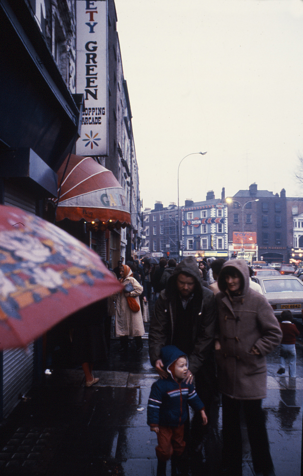
Built in the late 1980s, Stephen’s Green Shopping Centre stands on a site previously occupied by the Gaiety Green, a row of Georgian houses with small shop units rented out to vendors and known as the Dandelion Market at weekends. The site was put up for sale in 1980, and closed the following year, leading to the demolition of most of the original buildings. After several changes in ownership, construction of the shopping centre began in 1986, opening to the public two years later, in October 1988. [1]
The development came at a particularly relevant moment in the city’s history, marking the Dublin Millennium, an event that attempted to raise questions about its urban development through a series of projects such as the repaving of nearby Grafton Street, or the competition for a new monument for O’Connell Street, Dublin made a striking effort towards a change of attitude that modernised its image and public space. This milestone coincided with an urban renewal and social rehabilitation movement taking place all across Europe, and aimed to bring the city closer to other international capitals, while improving its citizen’s life quality through an array of polished and pleasant outdoor and indoor spaces. [2]
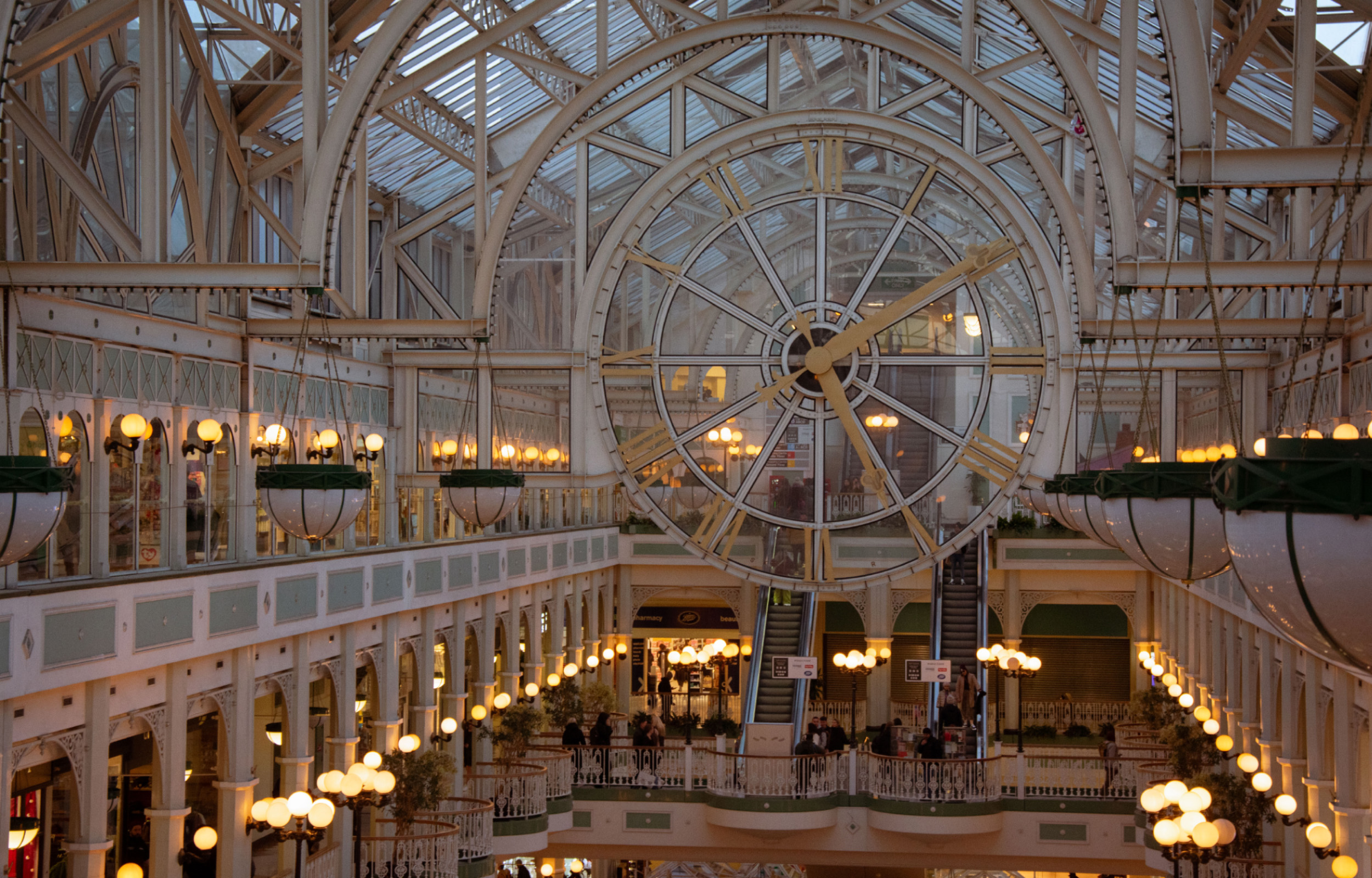
Stephen’s Green Shopping Centre, at the time of its opening, was no stranger to this context. In its design, architect James Toomey attempted to borrow some of these principles to conceive a commercial space that would recreate the feel and dynamics of an indoor street. With its winding circulation and glass-covered atrium featuring the renowned clock, the interior of the shopping centre resembled that of a 19th century train station or London’s Crystal Palace. The use of steel ornamentation continued throughout the building and onto the New Orleans style facade.
As is common for buildings of this style, its historicist postmodernism has been used against it by speculative developers, justifying its demolition under arguments disregarding its architectural value, measuring it purely on a matter of taste. This dialectic should come as no surprise, for the debate around the value of the “ugly and ordinary” as perceived by the architectural community, has been ongoing throughout the majority of the 20th century, and continues to be a conflictive topic. Even at the time of publication of Venturi and Scott Brown’s Learning from Las Vegas, now regarded as one of the key readings of postmodernism, their argument for studying what was then considered irrelevant or tasteless (“commercial vernacular” architecture) was strongly criticised or even dismissed by the architectural community. [3] We may therefore rescue some of their arguments to, at the very least, consider the architectural value of the shopping centre beyond arguments based merely on taste.
Half a century later, the economic forces at play are pushing for a shift in style, entirely conditioned by the profitability of the design, and made palatable to the public under the guise of architectural prestige. The simplification that took over the buildings analysed by Robert Venturi and Denise Scott Brown is common to developments at a global scale, seeking for neutral spaces that can be easily adapted at a lower cost, and blending the image of our cities into a homogenous global aesthetic in the process. The inevitability of this trend we appear to be passengers to, however, is confronted by an attitude from the public that refuses to step back and watch as it takes place. As we have seen by the engagement and involvement Dublin's citizens have taken in the Save Stephen’s Green Campaign, there is a sense of responsibility to participate in the city-making process, to make our voices heard in order to preserve and enhance the parts of our cities we find value in.
The statement that Stephen’s Green Shopping Centre is not old enough to be classed as heritage is not particular to this building, as it is a path we are going down with other 20th century buildings, prompting a dilemma to be considered by planners and developers: what constitutes heritage? The limits of what can be considered historic or worthy of preservation and protection are not based solely on a matter of age, as the Heritage Council states in its objection to the redevelopment plan, citing the shopping centre as “an iconic 20th century building of architectural interest and as a landmark building”. [4] Accordingly, other factors such as character, significance, and as pointed out by the Council, “architectural interest”, are at play in the issue of heritage.
What is or not historic does not depend exclusively on the year of construction, a conception of ‘old’ that can and will always become so as enough time passes, and we should not lose sight of the fact that not every building has the potential to become heritage. What is potentially historic is a question concerning the previously stated factors, first and foremost the relationship that us as citizens establish with architectural landmarks of our cities.
Will these commercialised, optimised for profit buildings ever become historic? In our campaign for the preservation of Stephen’s Green Shopping Centre, it became apparent that it was precisely the least profitable aspects of the building that people were most attached to. The atrium - arguably a profitless waste of space; the feel of an indoor space with its winding and oftentimes confusing circulations. Each served a purpose that went beyond the purely commercial as they allowed visitors to establish a connection with the shopping centre. By enabling us to regard the building as a landmark and a part of our identity, the creation of experiences and memories in a space that pushed the limits of the strictly mercantile inspired a movement to save it from demolition.
The reactions to the campaign were an excellent gauge of the public opinion, showing that while people are critical of the building’s flaws and its current state of decay, they care for it and want investment and effort to be put into renewing it, a proof that we collectively assign value to what we develop a relationship with.
We must, therefore, find a way to reconcile commercially viable and to some degree, standardised architecture, with the city’s character. While financial viability cannot be ignored, particularly in the current economic climate, failing to address this may result in a loss of the citizen’s sense of belonging, and a deterioration of our public and urban spaces.
In the current global situation, facing an overwhelming array of crises, both social and environmental, we cannot afford to settle for throwaway architecture. In an increasingly divided world, the processes taking place and shaping our cities demand us to take a step forward, paying close attention to them and assuming an active role in their making.
In this article, Marta Hervás Oroza examines how the redevelopment of Stephen's Green Shopping Centre has prompted a reassessment of what qualifies as heritage; as well as the role active participation plays in shaping our built environment.
Read

Website by Good as Gold.